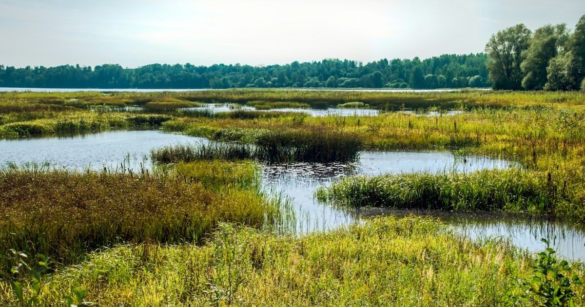
The parcel cleared every check that usually matters: power was close, the price per acre was right, the zoning allowed heavy industrial use outright. Grading started, and the excavator hit standing water and hydric soil in the corner where the access road was supposed to go. That corner is a wetland, and moving dirt in it without a federal permit is not a paperwork oversight to fix later – it is a Clean Water Act violation the moment the first bucket moves, with a stop-work order and remediation cost that dwarfs whatever the permit would have taken.
This is a different question from the one our environmental compliance guide and our site drainage guide already answer well. Those cover the state and local permits every site needs – zoning, stormwater quality, air and electrical permits – and the civil engineering of managing runoff once construction is underway. This is upstream of all of that: whether the ground itself can be touched at all without a separate federal sign-off, and that answer has to be settled before the site is committed, not during construction.
What Section 404 Actually Regulates
Section 404 of the Clean Water Act requires a permit from the US Army Corps of Engineers before dredged or fill material can be discharged into a “water of the United States” – a category that includes many wetlands, not just rivers and lakes. For a mining site, the trigger is almost never a dramatic marsh in the middle of the parcel. It is more often a low, seasonally wet corner that looks like unremarkable scrub most of the year, exactly the kind of ground that gets assigned to an access road or a stormwater basin because nobody wanted to put a container pad there.
What counts as a federally jurisdictional wetland changed materially with the Supreme Court’s 2023 decision in Sackett v. EPA, which narrowed the Clean Water Act’s reach to wetlands with a continuous surface connection to a relatively permanent water body – removing many isolated or intermittently connected wetlands from federal jurisdiction that would have been covered under the prior, broader standard. That narrowing is real and worth knowing, but it is not a reason to skip the check: plenty of wetlands still meet the narrower test, and several states maintain their own wetland protection statutes that apply independently of federal jurisdiction regardless of how the Clean Water Act’s reach is drawn. A parcel can be wetland-regulated at the state level even in a year the federal test would say no.
Finding Out Before You Sign, Not After You Break Ground
The sequence that avoids the stop-work scenario is cheap and happens entirely before site control:
- Pull the National Wetlands Inventory map for the parcel first. This is a free, public federal dataset and the fastest possible screen – it will not give a legally binding answer, but it tells you in minutes whether the parcel is worth a closer look at all.
- Check the county soil survey for hydric soil designations. Hydric soils are a core indicator used in formal wetland delineation, and a parcel flagged hydric in the soil survey deserves a field check even if the wetlands inventory map shows nothing, because the inventory map is drawn from aerial imagery and regularly misses smaller or wooded wetlands.
- If either check raises a flag, commission a wetland delineation before closing on the site, not after. A qualified wetland delineation is a field survey against the three-factor federal methodology – hydrology, hydric soils, and wetland vegetation – and it is the only answer that holds up to the Corps, not a desktop guess.
- Request a jurisdictional determination from the Corps once the delineation is done. A preliminary JD is faster and is treated as non-binding for planning purposes; an approved JD takes longer but is the version a lender or hosting client can actually rely on.
If There Is a Wetland: Two Permit Paths, and the Trade-Off Between Them
Finding a jurisdictional wetland on part of the parcel does not automatically mean the project is dead. It means choosing between two very different federal permit paths, and the choice is made by the SIZE and nature of the unavoidable impact, not by preference:
| Path | When it applies | Trade-off |
|---|---|---|
| Redesign to avoid the wetland entirely | Whenever the pad, access road or line route can be shifted to dry ground | No federal permit needed at all for that feature – almost always the cheapest and fastest option if the site layout allows it, which is why this is checked first |
| Nationwide Permit (general permit) | Minor, unavoidable impacts below the acreage threshold set for the applicable permit category – a single access-road crossing or a buried utility line crossing a narrow wetland edge are common qualifying cases | Faster review than an individual permit and no public comment period, but still requires pre-construction notification to the Corps for most categories and often requires compensatory mitigation even for a qualifying minor impact |
| Individual Permit | Impacts too large or complex to qualify for any Nationwide Permit – a pad or lagoon that genuinely has to sit on regulated wetland | Substantially slower, since it includes public notice and comment and a full alternatives analysis, and it is the path most likely to draw outside opposition during the comment period – the federal equivalent of the public hearing risk our environmental compliance guide already describes for local conditional-use permits |
The redesign option is underused simply because site plans get finalized for power and civil-engineering reasons before anyone checks the wetlands map, at which point moving the road feels like it costs more than it actually would have cost if drawn correctly from the start. Checking before the layout is finalized, not after, is what keeps this option on the table.
Compensatory Mitigation Is Usually Part of the Price, Even for a Minor Permit
Both permit paths in the table above commonly carry a condition that catches first-time applicants off guard: even a Nationwide Permit for a small, unavoidable crossing often requires compensatory mitigation – replacing the function of the wetland being filled, not just paying a fee to make the paperwork go away. The three usual mechanisms are buying credits from an approved wetland mitigation bank in the same watershed, paying into an in-lieu fee program administered by a third party, or restoring or creating wetland acreage on or near the project site directly. Mitigation banking credits are generally the fastest and most predictable of the three for a small crossing, since the restoration work was already done and approved before your project exists; permittee-responsible mitigation, where you build and maintain the replacement wetland yourself, is usually the slowest and carries the most ongoing obligation, since the Corps typically requires monitoring and performance standards for several years after construction, not just a one-time planting.
The ratio of replacement to impact is set by the Corps on a case-by-case basis and is not something to estimate in advance – but the direction is consistent: mitigation is sized to replace ecological function, not just acreage, so a higher-quality wetland generally costs more to offset than a low-quality, already-degraded one of the same size. This is one more reason the redesign-to-avoid option in the table above is worth a real engineering look before being dismissed as impractical, since it is the only path with no mitigation obligation at all.
What This Means for Scheduling
Build the uncertainty into the project timeline rather than assuming the fastest case. A desktop screen takes days. A field delineation, once scheduled, typically takes longer where the growing season or water table timing matters for accurately reading vegetation and hydrology indicators. A Nationwide Permit review and an Individual Permit review are not close to the same length of process, and the gap between them is exactly the kind of schedule risk that a power interconnection timeline or a state permitting timeline does not warn you about on its own, because it is a separate federal process running in parallel, not a line item inside the state approval you are already tracking.
Before You Commit to a Site: A Short Checklist
- Pull the National Wetlands Inventory map and the county hydric soils layer before signing a lease or purchase agreement – both are free and take minutes.
- If either flags the parcel, get a professional wetland delineation before closing, and budget the schedule for it rather than assuming the fastest-case timeline.
- Ask whether your state has an independent wetland protection statute, since a narrower federal jurisdiction after Sackett v. EPA does not guarantee a narrower state one.
- Before accepting a wetland impact as unavoidable, get the site layout reviewed for a redesign that moves the pad, road or line route onto dry ground – it is usually the cheapest permit of all: none.
None of this replaces review by a qualified wetland consultant or an attorney familiar with Clean Water Act permitting for a specific parcel – this guide is grounding for that conversation, not a substitute for it. Rax Mining’s hosted facilities are already sited and permitted, which removes this risk entirely for a hosting client. Contact us to discuss hosting your fleet at an already-permitted site, or see our available hardware if you are sourcing miners for a hosted deployment.
Explore Rax Mining
- Bitcoin Miner Hosting — Tiered rates from $0.085/kWh, NatGas from $0.055/kWh
- NatGas MDU Units — 1MW modular datacenter containers
- Mining Profitability Calculator — Estimate your mining returns
- Our Facility — Tour our mining infrastructure